This article first appeared in Digital Edge, The Edge Malaysia Weekly on November 1, 2021 - November 7, 2021
Tree planting is a popular activity that corporations and governments like to organise in order to reduce carbon emissions and preserve biodiversity. In fact, Malaysia’s former prime minister Tan Sri Muhyiddin Yassin kicked off the 100 million Tree-Planting Campaign 2020-2025 last year.
This activity has also been used to generate carbon credits that entities can purchase to offset or cancel out their own carbon emissions. The problem is that while planting trees is good, cutting down an old-growth forest and planting a few new trees that will take decades to mature does not exactly help mitigate climate change, especially when greenhouse gases (GHG) continue to be emitted.
This issue has been highlighted by many scientists and observers, who suggest that equal focus should be given to halting deforestation and reducing GHG emissions in the first place. And if tree-planting activities to offset carbon emissions continue, being mindful of the type of trees that are planted, as well as how and where they are planted, will be critical.
Technology can assist in achieving the latter. For instance, IBM researchers managed to use their geospatial data analysis platform, PAIRS, to measure the natural carbon storage of different kinds of trees.
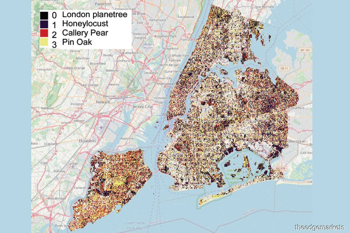
They tried it out in Manhattan, New York, by using high-resolution imagery from satellites and LiDAR (light detection and ranging technology) to identify all the trees in the city. Then, they ran a model to ascertain the tree species and calculate the carbon stored in each tree. The model took into account the species, geometric shape and volume of foliage of the trees in question.

“We use machine learning, artificial intelligence and image processing tools on satellite images to train the models to extract tree location, type, height and dimensions, and tree biomass. From the type of trees and their calculated biomass, the carbon stored in trees is calculated using tree-specific models, including their above and below ground biomass,” Levente Klein, a research staff member doing geospatial analytics at IBM Research, tells Digital Edge.
“We also look at how fast trees are growing to understand the amount of carbon dioxide extracted from the atmosphere and converted into carbon. In the past, such models were based on generalisations from one or two locations, as there were no tools to identify tree species, dimensions and biomass at the individual tree level.”
They found out that Manhattan’s trees were sequestering 52,000 tons of carbon and identified the effectiveness of the different species. The model can also calculate the density of tree distribution at various neighbourhoods and spot empty plots or locations where new trees can be planted.
“The information of tree locations and sizes can also be used to identify their cooling [effect] due to shade [from the tree cover] and how this is impacting urban heat islands,” says Klein.
Essentially, PAIRS allows companies and scientists to obtain results from climate, weather and satellite data instantly. It could also be useful for farmers who want to compare their crop performance with that of other farmers, and for environmental organisations to understand land cover, food security and water availability issues.
“PAIRS is a data store with advanced analytics. It can calculate the availability of forested land and establish long-term trends of forest cover from historical data. PAIRS can also monitor trends like deforestation and wildfires, and inform stakeholders of changes,” Klein explains.
As for companies that want to offset their carbon footprint with carbon credits, PAIRS data could help them determine the best locations and help them monitor the progress. “Using multiple time shots, PAIRS can ensure that the land use did not change and provide data and information that can be verified based on scientific methods,” he says.
Save by subscribing to us for your print and/or digital copy.
P/S: The Edge is also available on Apple's AppStore and Androids' Google Play.