This article first appeared in Digital Edge, The Edge Malaysia Weekly on December 13, 2021 - December 19, 2021
Advanced modelling and satellite data have enabled scientists to study and predict many geographical changes that have occurred or will occur in various parts of the world. Here are some maps found online for free that either detail what has transformed in Malaysia or is bound to happen in the next few decades due to climate change.

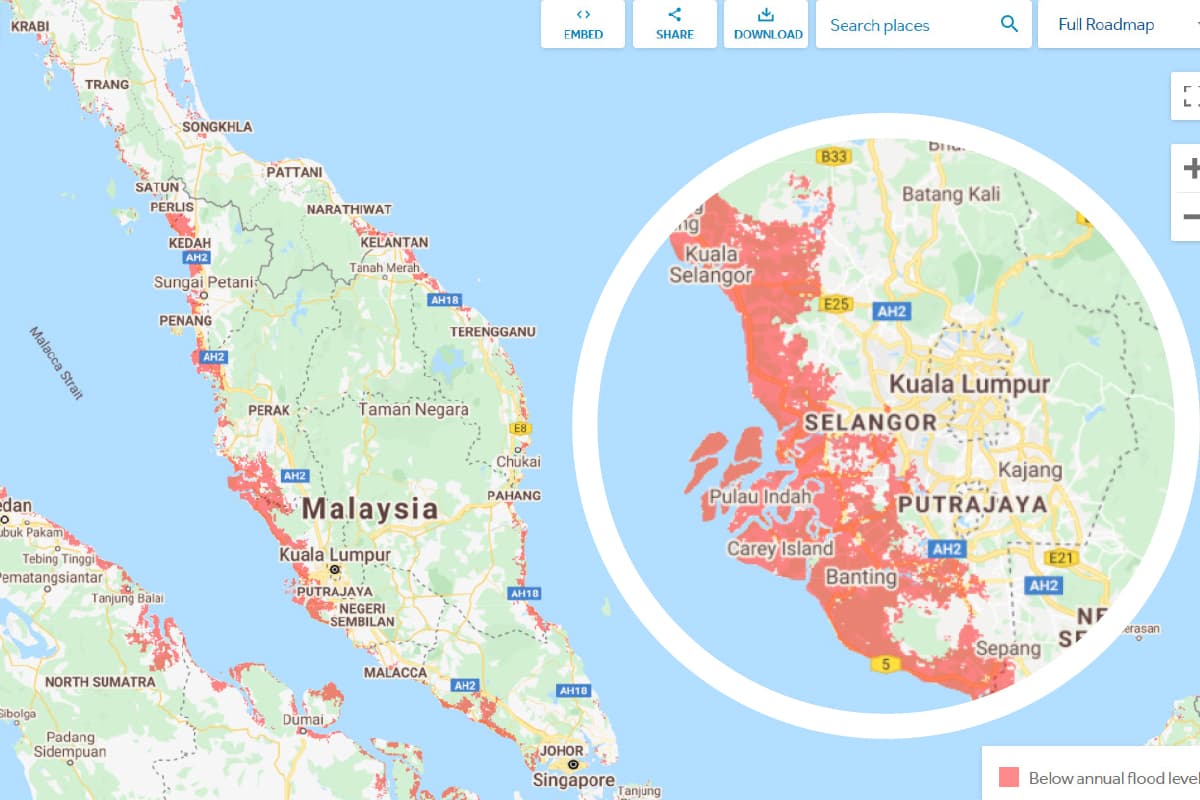
1 Sea-level rise and coastal flooding due to global warming and melting ice sheets
Climate Central, a non-profit news organisation based in the US, generated maps predicting which areas will be under the sea level in the next few decades based on peer-reviewed science in leading journals. The areas in red are below water level.
Another version of the map shows potential flooding in Klang under a 2°C or 4°C warming scenario. According to the UN, global average temperatures are already 1.1°C higher than pre-industrial times.

2 Forest and tree cover loss in Malaysia
The Global Forest Watch (GFW) platform has plenty of maps to show how land cover, forest change, land use, fires and the climate have changed over the past decades. It also has information on the main states in Malaysia responsible for tree cover loss and gain as well as deforestation alert sources. GFW offers free, real-time data, technology and tools to monitor the world’s forests. It also has an Open Data Portal.

3 Nitrogen dioxide satellite measurements for air quality
Nitrogen dioxide is primarily released in the burning of fuels, which could be from vehicles, power plants and equipment. Breathing in air with high nitrogen dioxide levels can irritate airways and aggravate respiratory diseases. This map is generated by Resource Watch, a platform hosting many data sets from various sources. This particular map was generated using data collected from the Sentinel-5 Precursor mission, a low Earth orbit polar satellite system.
Other data sets include intact forest landscapes, solar energy potential, predicted vulnerability of fisheries to climate change and other non-climate topics.
Save by subscribing to us for your print and/or digital copy.
P/S: The Edge is also available on Apple's App Store and Android's Google Play.